ThinkGeo Cloud
ThinkGeo UI Controls
ThinkGeo Open Source
Help and Support
External Resources
ThinkGeo Cloud
ThinkGeo UI Controls
ThinkGeo Open Source
Help and Support
External Resources
This is an old revision of the document!
ThinkGeo Cloud offers a cloud-hosted suite of APIs that allow you to easily consume map tiles, geocode and reverse geocode, perform spatial operations and other GIS services. Whether you're just evaluating the Thinkgeo Cloud or you're a subscriber, this quick start guide will help you start consuming these services in your own applications.
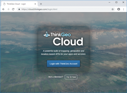
You can login to the ThinkGeo Cloud with your ThinkGeo account, the same one you can use to access our community forums. If you don't have a ThinkGeo account yet, sign up for one here.
Then, visit the ThinkGeo Cloud web console login page at https://cloud.thinkgeo.com/login.html and click the “Login with ThinkGeo Account” button.
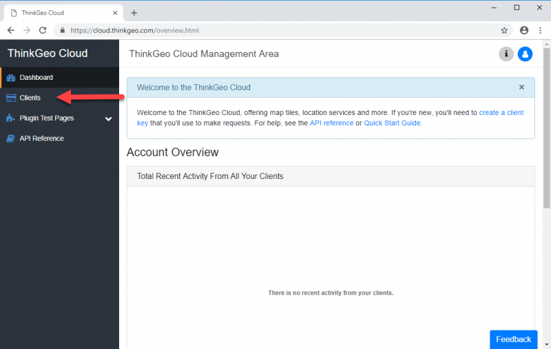
Once logged in, you'll be at the Dashboard page of the ThinkGeo Cloud web console. The Dashboard offers a quick look at the activity of your ThinkGeo Cloud clients over the past 24 hours. If you're a new user, you won't see any activity here.
You’ll want to start your experience by creating a *client* within ThinkGeo Cloud. A client is how you can enable your application or website to use ThinkGeo Cloud resources on your behalf. There are two types of clients for different kinds of applications, and each has its own ID and secret key. You can have as many clients in your account as you like.
To manage your clients, begin by clicking on the “Clients” button on the menu bar.
New ThinkGeo Cloud accounts come with two clients, one of each type, that you can use to quickly get started.
For now, let's use one of the default clients that come with your ThinkGeo Cloud account. For this exercise, we'll choose the Native Confidential client called “Sample Native Client”.
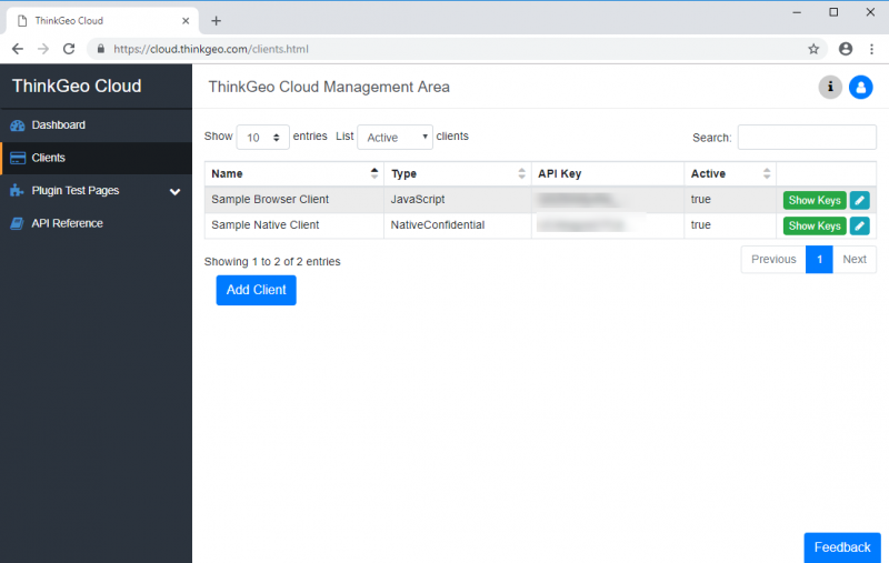
To use this client, you'll need its ID (or API Key) and secret. These can be displayed if you click on the green Show Keys button. The “Client Details” dialog will appear, showing you both the API Key and API Secret as follows:

You can use the “Copy” button to copy these values to your clipboard.
The ThinkGeo Cloud offers a built-in way for you to explore the available APIs. To use it, click on the “API Reference” menu button. This will open a new browser tab to the ThinkGeo Cloud API Explorer.

On this page, you can use the API Key and API Secret from your Sample Native Client to authenticate, and then experiment with the available APIs.
To do so, click the “Authorize” button:

On this dialog, in the Client Credentials (OAuth2, application) section, do the following:
After successfully authenticating, you can close the dialog box.
You can now experiment with the following APIs be expanding the corresponding sections and clicking the “Try it out” button:

Additionally, your Sample Native Client gives you access to a select few additional APIs that can be used to query or manage your account information, including:
The ThinkGeo Cloud web console comes built-in with simple sample applications that help demonstrate the main services on offer: Elevation, Reverse Geocoding, World Imagery and World Streets.
You can access these sample by clicking the “Plugin Test Pages” menu item to expand it, and then choosing a sample from the list below.
Here's a screenshot of the Reverse Geocoder sample page, which lets you click on the map anywhere in the world to see a list of nearby points of interest.

ThinkGeo offers two prepackaged API clients for developers who want to use the ThinkGeo Cloud APIs in their applications. Currently the following API clients are available:
Would you like to see API clients in your language? Let us know what languages you'd like to see by emailing us at sales@thinkgeo.com.